
Monthly Archive:: August 2016
Interactive Maps
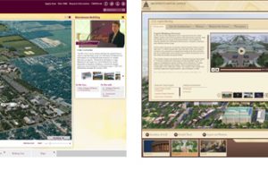
Interactive Maps: Panels Versus Windows
CampusTours / August 10, 2016
The interactive map has become a staple on most organizational Web sites, often providing visitors with their first glimpses of your location and facilities. As online maps have proliferated, a
Interactive Maps
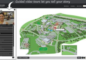
Interactive Maps with Guided Video Tours
CampusTours / August 8, 2016
When prospective students or visitors arrive at the online campus map, often it is their first glimpse of your campus. Many times, these visitors do not yet have a firm grasp