Interactive Maps Archive
Featured

AnyTour Adds Immersive Video Tours
CampusTours / October 12, 2024
Gemological Institute of America has recently implemented the new CampusTours ImmersiveVideoTour CampusTours is proud to announce the debut of CampusTours’ newest virtual tour product – ImmersiveVideoTours! In
Interactive Maps

Launching Video or Audio Tours from QR Codes on Building Signs
CampusTours / December 7, 2023
Colleges Embrace Technology: Launching Video or Audio Tours from QR Codes on Buildings Colleges and universities are increasingly adopting innovative technologies to enhance the student experience and attract prospective
Featured
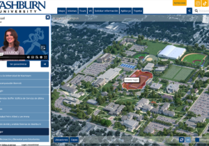
AnyTour Adds Language Toggle
CampusTours / August 25, 2023
CampusTours new AnyTour 7.0 system may now be configured to include an international Language Toggle feature. Unlike other virtual tour systems, CampusTours AnyTour toggles the entirety of the interface,
Featured

AnyMap & AnyTour Add Support for Audio Description (AD) Video
CampusTours / August 18, 2023
The virtual tour presentation for the National Institutes of Health implements support for Audio Description (AD) videos. CampusTours AnyTour continues to add new accessibility features and support, and now
Featured
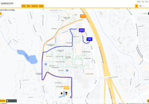
Move-In Maps Help Schools Manage Return to Campus
CampusTours / July 27, 2022
Kennesaw State University’s custom Move-In Maps (https://maps.kennesaw.edu) As colleges and universities begin to prepare for Return to Campus weekends, and millions of families pack up the family car
Interactive Maps
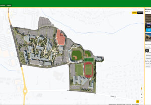
AnyMap Adds Satellite Map Integration
CampusTours / May 31, 2022
Hudson Valley Community College Interactive Campus Map The CampusTours AnyMap system now supports the integration of custom map overlay graphics over popular satellite map platforms like GoogleMaps. Custom
Interactive Maps

Interactive Maps in Multiple Languages
CampusTours / May 23, 2022
University of North Carolina at Charlotte Multiple-Language Interactive Campus Map As international students apply to US institutions, colleges and universities are racing to update their digital media to address
Featured
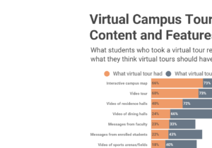
What Students Say They Want in Virtual Tours
CampusTours / March 29, 2022
When asked by InsideHigherEd what content and features they desire in virtual campus tours, students are very clear with their top choices: Interactive Campus Map Video Tour Video
Featured

Map Styles Offer Different Advantages
CampusTours / March 20, 2022
Organizations use a wide variety of styles of maps to convey different information. CampusTours AnyMap supports all of these map styles, as well as pretty much any other style
Featured
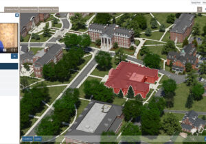
Campus Maps Deliver Online Video Orientations
CampusTours / September 21, 2021
Coupling videos with coordinated map movement is a feature CampusTours first debuted in virtual tours in 2009, but the use of “map coordinated video” has seen a dramatic rise
