
Interactive Maps Archive
Featured
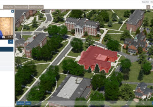
Campus Maps Deliver Online Video Orientations
CampusTours / September 21, 2021
Coupling videos with coordinated map movement is a feature CampusTours first debuted in virtual tours in 2009, but the use of “map coordinated video” has seen a dramatic rise
Featured

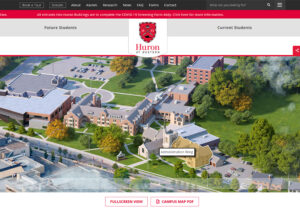
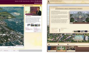
Inexpensive Aerial Photographs Offer Quick Campus Maps
CampusTours / September 21, 2021
As the costs of creating custom map artwork continue to rise, organizations are increasingly considering less-expensive alternatives including aerial photography. Aerial photograph maps utilize aerial photos taken from a
Featured
Embedded AnyMap
CampusTours / September 14, 2021
Embed your interactive campus map into your Website with AnyMap
Featured
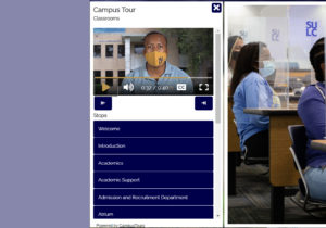
Virtual Tours During COVID-19
CampusTours / January 25, 2021
As campus closures multiplied in 2020 during the COVID-19 crisis, virtual tours became a lifeline for prospective students, parents, extended family and friends to research potential educational opportunities. Traffic
Interactive Maps
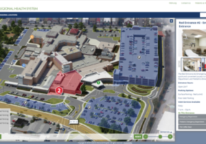
Interactive Hospital Maps
CampusTours / October 10, 2018
Frederick Regional Health System uses CampusTours AnyMap to help route both English and Spanish language visitors to appropriate entrances and services. Interactive Hospital Maps Hospitals and health care facilities are
Interactive Maps
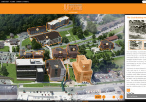
Historical Building Layers on Interactive Maps Drive Alumni Visits
CampusTours / February 7, 2018
The University of Pikeville Photorealistic Map (map.upike.edu) includes a History Layer When developing interactive maps, colleges often focus on prospective and current students, but alumni are a crucial source of
Interactive Maps
Interactive Maps: Panels Versus Windows
CampusTours / August 10, 2016
The interactive map has become a staple on most organizational Web sites, often providing visitors with their first glimpses of your location and facilities. As online maps have proliferated, a
Interactive Maps
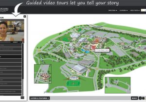
Interactive Maps with Guided Video Tours
CampusTours / August 8, 2016
When prospective students or visitors arrive at the online campus map, often it is their first glimpse of your campus. Many times, these visitors do not yet have a firm grasp
Interactive Maps
AnyMap & AnyTour Integrate GoogleMaps
CampusTours / July 21, 2016
CampusTours AnyMap and AnyTour now feature the ability to add GoogleMaps to showcase exciting local destinations, businesses in town, local historic attractions, regional or off-site campus locations, study abroad
Interactive Maps

Directions, Road Closures and Seasonal Events
CampusTours / December 16, 2015
When your campus is under construction (and this is a near-perpetual state at many institutions today), your interactive map needs to provide clear and well-marked indications of road closures,