
Author Archive
Interactive Maps
Graphical Layers on Interactive Campus Maps
CampusTours / July 6, 2015
Interactive maps can graphically color or mark related buildings and campus locations. Graphical layers make it much easier for prospective students, current students and other campus visitors to quickly
Virtual Tours
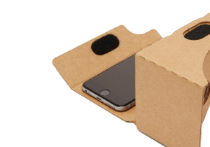
CampusTours Cardboard VR
CampusTours / July 3, 2015
Virtual reality is coming, and CampusTours has solutions to allow you to test the VR waters while retaining a compelling virtual tour or interactive map for the 99%
Virtual Tours

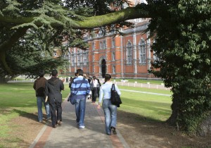
Student Commentary
CampusTours / July 2, 2015
How can personal student video vignettes help your institution create a more authentic virtual tour experience? When CampusTours conducted user feedback testing on several of our tours back in 2007, students consistently
Virtual Tours
Building Compelling and Differentiated Virtual Tours
CampusTours / June 2, 2015
What Differentiates Virtual Campus Tours? In this era of digital admissions, how do colleges stand out from their competitors? CampusTours has worked with hundreds of colleges, non-profits and government
Interactive Maps
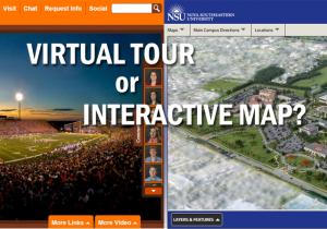
Virtual Tour or Interactive Map?
CampusTours / June 1, 2015
It’s an eternal institutional Web development question – do we develop an interactive map or a virtual tour … or both? The campus is where students will be spending their
Map Artwork
3D Vector Maps
CampusTours / May 20, 2015
For a clean, graphical treatment of a campus, nothing can beat a 3D Vector map. By simplifying the image and reducing the detail that is shown in Photo-realistic 3D Maps,
Virtual Tours
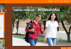
Virtual Tours Go International
CampusTours / May 17, 2015
Just a few years ago academic Web sites were usually presented in one language with only peripheral attempts made to accommodate foreign-language speaking audiences. Today schools are increasingly adopting
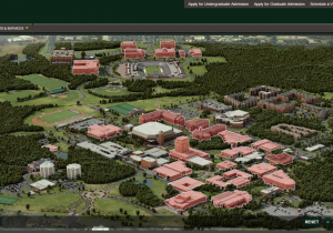
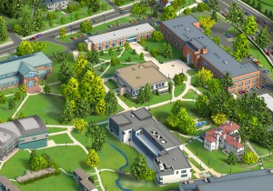
Map Artwork
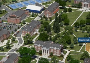
Photo-realistic 3D Maps
CampusTours / April 2, 2015
As long as there have been college visits, there have been campus maps. Originally developed for print and used in view books, freshmen course guides and welcome packets, campus