
Photo-Realistic Map Artwork: Lawrence Berkeley National Laboratory
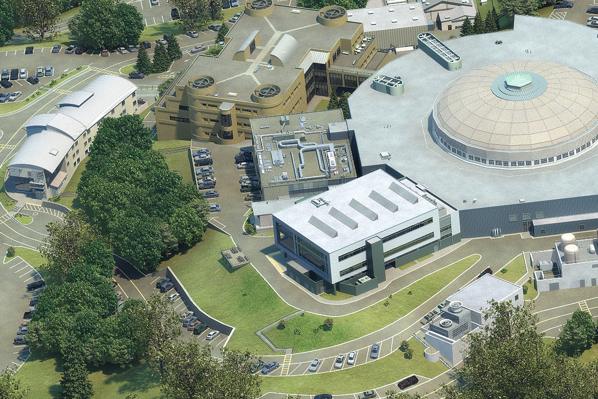
Lawrence Berkeley National Laboratory, in Berkeley, California, worked with CampusTours in 2012 to develop photo-realistic map artwork and an interactive campus map. The Lawrence Berkeley National Laboratory Campus Map Project included photo-realistic map artwork of the main campus, the Joint Genome Institute campus, the NERSC building in Oakland as well as selected locations in West Berkeley. Once completed, the photo-realistic maps were integrated into the AnyMap interactive map system, which includes a smartphone module for actual campus visitors allowing them to track their progress around campus using their phones’ GPS (Global Positioning System) capability. The Lawrence Berkeley National Laboratory Interactive Map also includes an extensive Roads & Parking feature allowing visitors to easily find roads and specific parking locations. View Project

